This post is an attempt to start a Mexican wave among computational social scientists (not only the urban science crowd) for the golden age of structural geography—the 1960s-80s. The main point is not to say geographers should have more credit but that literature from that era is a treasure trove of ideas. Neither is the point to find the true roots of ideas—indeed, many urban data scientists know even older economic geography, like Christaller’s theory of the 1930s or Kohl’s work from the 1850s. Rather, to share my favorite starting points for explorations into geography. Shout out to Carl Nordlund, who reminded me to write this blog post (I’ve thought about it many times before).
Although I have no formal training in geography, my fascination with the topic goes way back. My dad was an architect, and to escape the doldrums of Swedish suburbia, I occasionally leafed through his old textbooks. Spatial Organization by Abler, Adams, and Gould was a favorite. Especially the variety of illustrations fascinated me, and the fact that this was something considered valuable . . “it’s important for planning,” explained my father. For context, at least then, Swedes used to pride themselves in taking the middle way between market and planned economies. “Fair enough,” I thought, “the Swedish model needs economic geography.” But little did I know I would reach the same type of figures and thought myself much later, and from a very different direction.
Since my first forays into data science, I occasionally ran into geographers who blithely reminded me to check their literature. I guess, about a decade or so ago, I actually listened to them and went back to dust off Spatial Organization. So here are 11 examples that, to me, feel very modern for their time. Some would feel dated if presented at today’s urban data science conferences; some would still feel very fresh. Occasionally, I accompany these ideas with their urban-science soul mates—but in no case are the latter pure reinventions, and sometimes they are well-informed about their geographic predecessors.
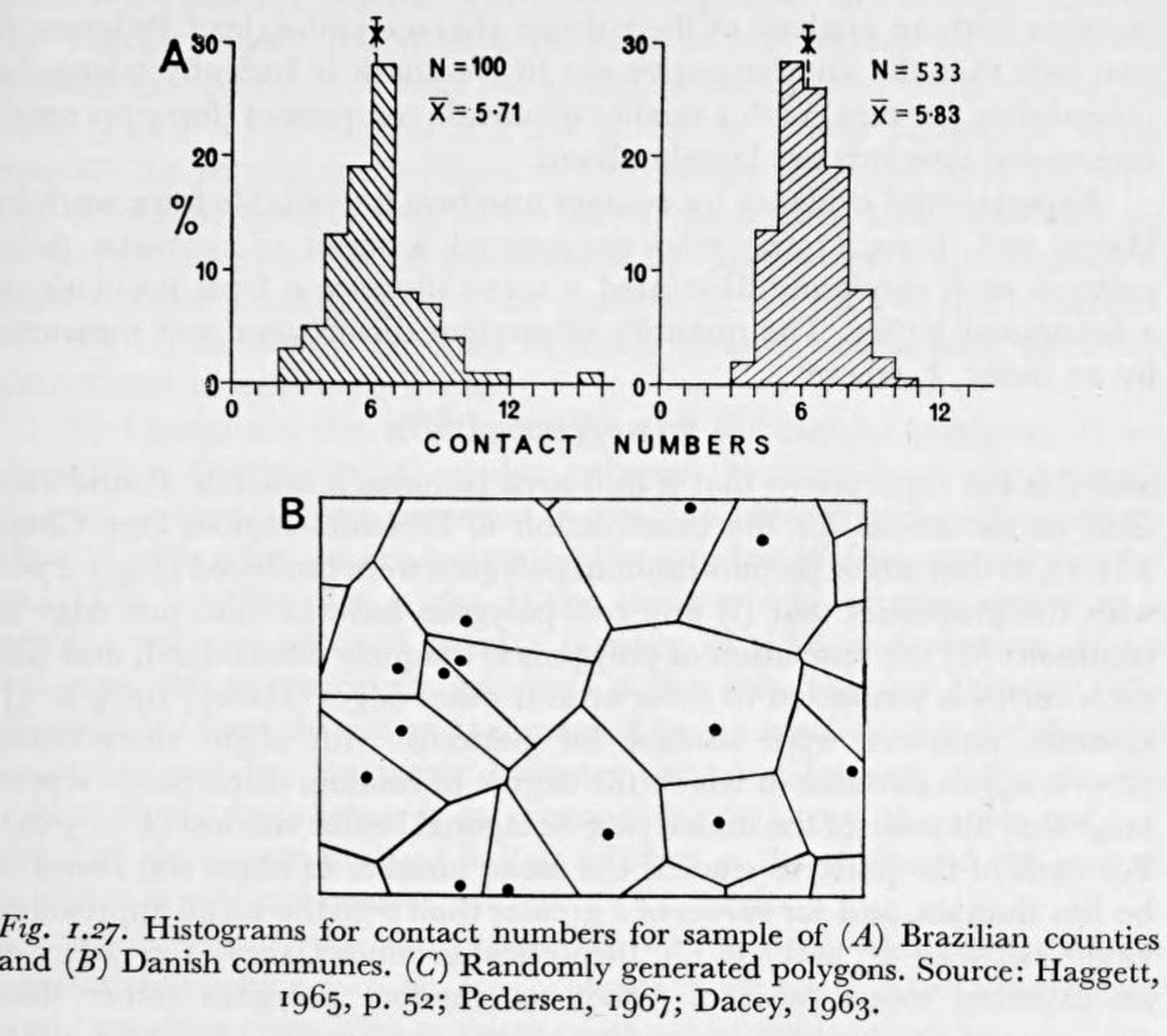
1. Degree distributions
2. Statistical network models

3. Street patterns

4. Shapes

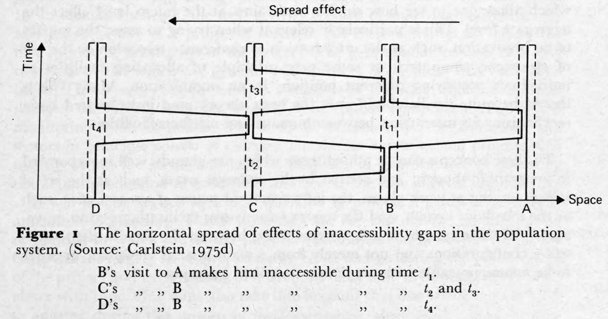
5. Trade-offs

6. Network structure

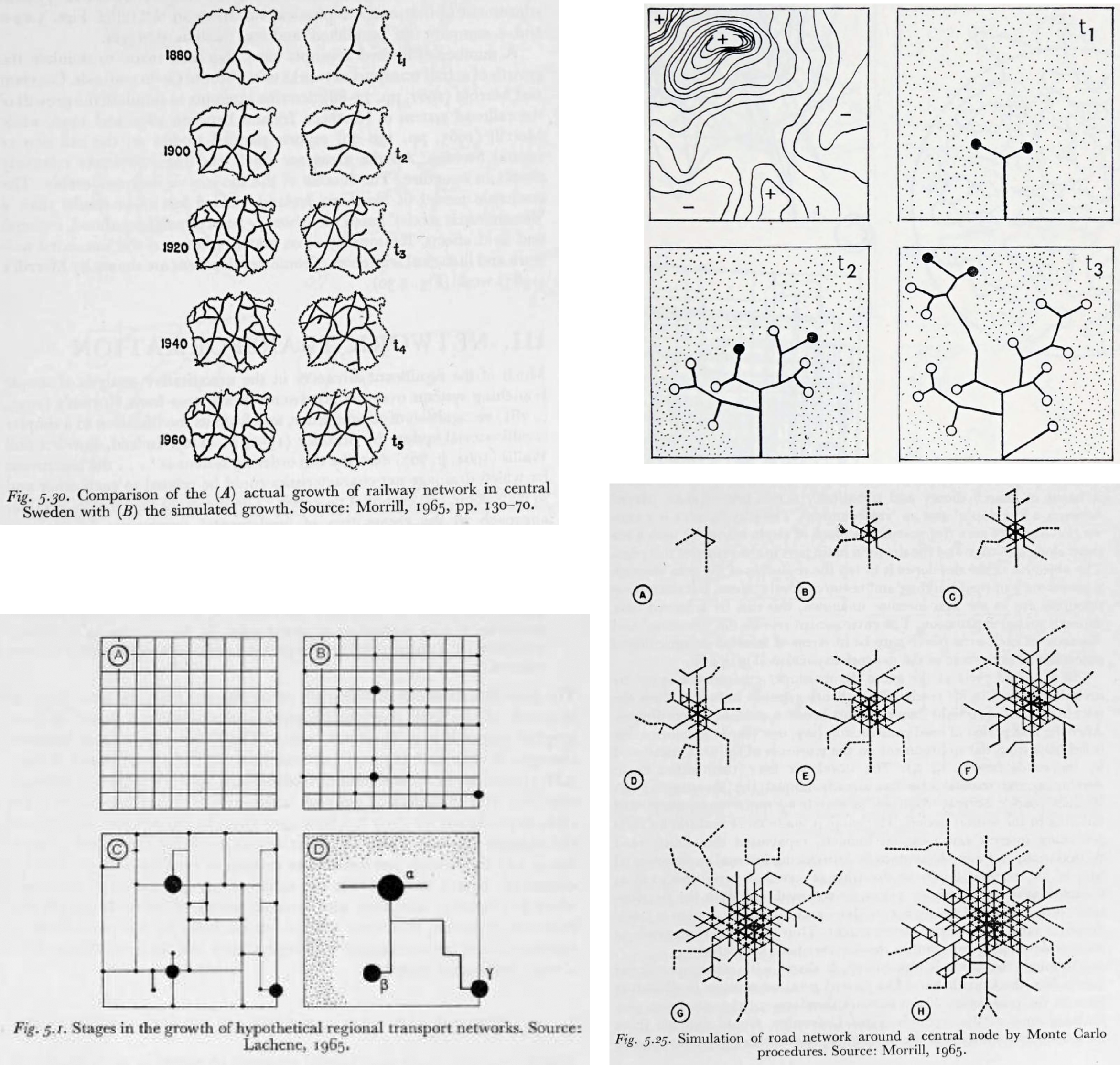
7. Network growth models
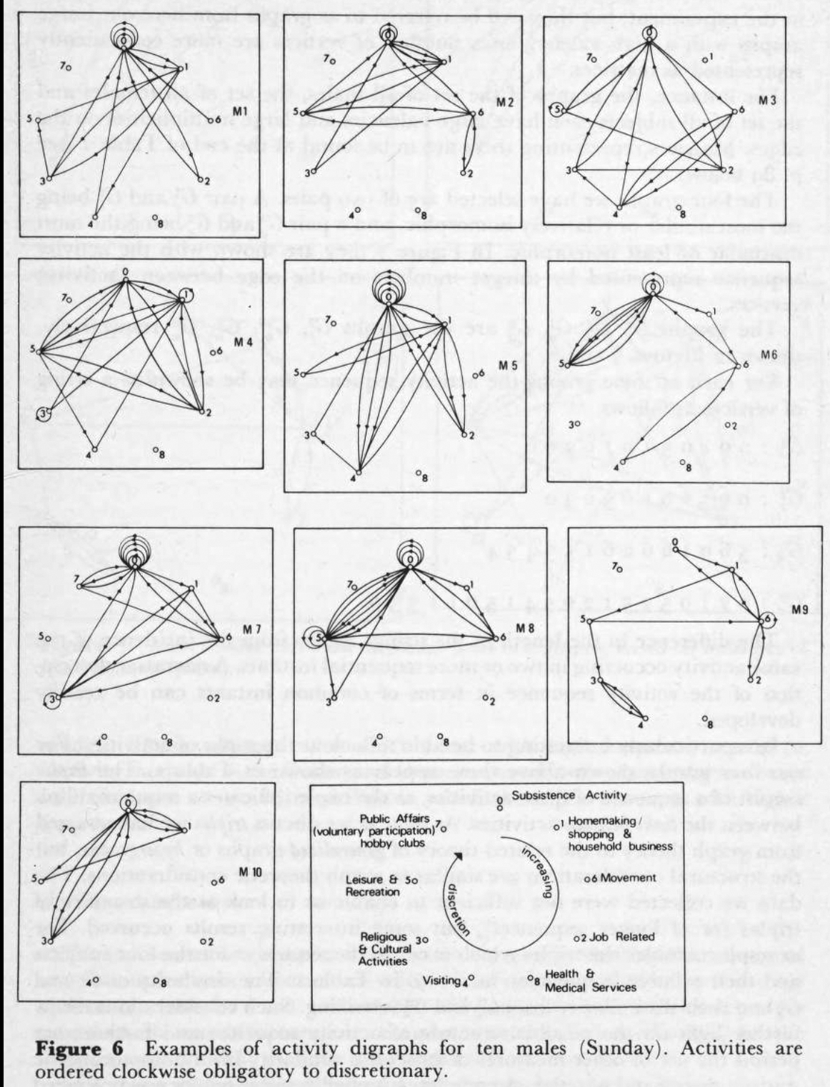
8. Life as multigraphs in a space of activities
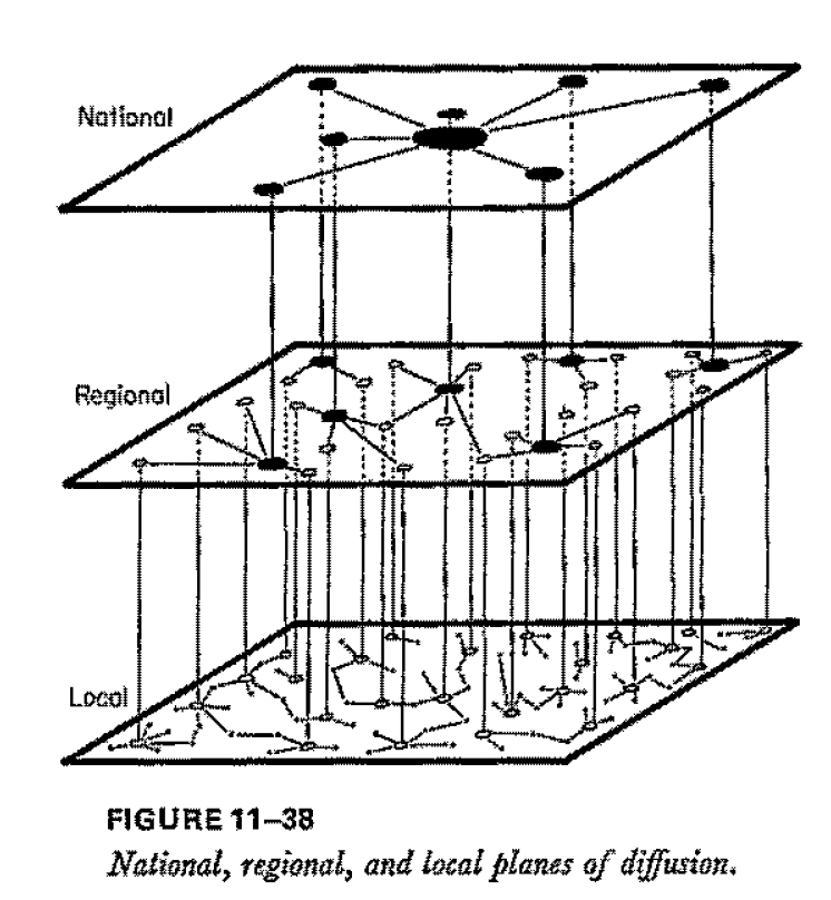
9. The levels of mobility
10. The constraints of temporal ordering
11. Typologies of movements and distribution

Finally
It’s interesting to imagine how the two paths—structural geography and urban data science—lead to similar ideas. (I’m getting a bit hypothetical and oversimplified now.) Economic geographers were already accustomed to mechanistic modes of thinking from e.g. above-mentioned Christaller et al. The main input they needed was how psychologists translated structuralism into graph theory—e.g., Katz centrality is frequently cited (inspired by Jennings and Moreno’s foundational work on social networks). Computational urban science of today comes from when complexity scientists (many with a background in statistical physics) ready to understand the world with minimal models and networks came across urban data. One side had geographic data and mechanistic models, and needed network science to take the final step; the other had models and networks and needed the data.
Key references
[AAG] Abler, Adams, Gould, 1971. Spatial organization. Prentice-Hall, Englewood Cliffs NJ.
[CPT] Carlstein, Parkers, Thrift, eds., 1978. Human activity and time geography. Edward Arnold, London.
[Ha] Haggett, 1969. Network analysis in geography. Edward Arnold, London.
[Ka] Kansky, 1963. Structure of transportation networks. University of Chicago Press, Chicago IL.
